
EDUCATION AND TRAINING
We believe education empowers us with the knowledge and skills to make a better world, one step at a time. That is why we want to share what we’ve learned with you.
Training Services
- Real-time Training
- 13 unique courses
- Flexible course schedules
- Custom trainings tailored to your needs
- Access to instructors for questions / demos
Introduction to ArcGIS Pro
In this course, students will receive an introduction to the fundamentals of desktop GIS and the ArcGIS Pro software. The course begins with an introduction to Geographic Information Systems and then proceeds with an overview of the ArcGIS Pro interface and the basics of working with spatial data.
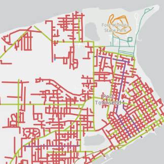
Cartography with ArcGIS Pro
In this course, students will explore the fundamentals of cartography, from basic map design to advanced techniques and web mapping. Through an understanding of cartography design principles, students of this course will have developed the skills they need to efficiently implement what they have learned in cartography projects using ArcGIS Pro.
Arc Hydro
In this course, students will learn the fundamentals of Arc Hydro in ArcGIS Pro. This includes learning the Arc Hydro data model, learning tools to build and apply the data model, and exploring case studies implementing the Arc Hydro data model.
ArcGIS Pro ModelBuilder for Data Management and Geoprocessing
In this course, students will explore ArcGIS Pro ModelBuilder workflows for data management, geoprocessing, and data analysis. From simple to complex GIS workflows, ModelBuilder is a powerful tool for efficient repeatable processing in ArcGIS Pro. Upon completion of this course, students will have the capacity to use ModelBuilder effectively in a wide range of applications.
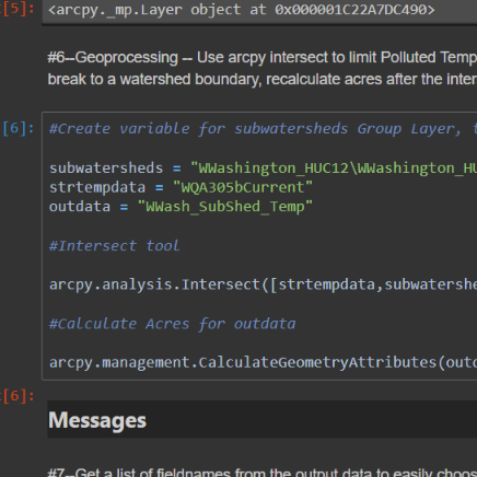
Advanced Geoprocessing with ModelBuilder and Python in ArcGIS Pro
In this course, students will explore advanced ArcGIS techniques for geoprocessing, data analysis, project management, and metadata. From simple to complex GIS workflows, ModelBuilder and Python scripting are powerful tools for efficient repeatable processing in ArcGIS Pro. Upon completion of this course, students will have the capacity to use both ModelBuilder and Python in a wide range of applications.
Python in ArcGIS
In this course, students will learn the fundamentals of Python scripting in ArcGIS Pro and explore its many applications throughout the ArcGIS platform.
Arcade Scripting
In this course, students will explore the fundamentals and application of Arcade as an expression language. Students will learn to customize styles, labels, pop-ups, and ArcGIS Online (AGOL) data driven Dashboards through Arcade custom scripts.
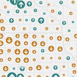
Introduction to ArcGIS Online (AGOL)
In this course, students will explore the fundamentals of ArcGIS Online (AGOL) as a powerful web mapping software for creating and managing content, building interactive web maps and apps, and sharing spatial information.
ArcGIS Online for GIS Professionals
In this course, students will explore advanced web GIS techniques through an in-depth coverage of the ArcGIS Online (AGOL) environment. Upon completion of this course, students will be able to more effectively create and manage content, as well as build informative and impactful web applications.
Experience Builder
In this course, students will explore the fundamentals of ArcGIS Experience Builder as a powerful tool for building highly customizable web applications with little or no coding required.
Field Maps
In this course, students will learn how to configure Field Maps for efficient and accurate mobile data collection. Students of this course will learn the fundamentals of building a relational geodatabase, setting domains and contingent values, and testing data collection configurations in the Field Maps mobile app.

Survey123
In this course, students will learn how to configure forms and surveys using Survey123, a powerful form builder for collecting, analyzing, visualizing, and sharing data. Students of this course will learn the fundamentals of the Survey123 web designer as well as the Survey123 Connect desktop application.

Survey123 and Field Maps
In this course, students will learn how to configure simple to complex forms for data collection in Survey123 and Field Maps. Students will gain a thorough understanding of each application's core functionality and explore the wide range of available tools for designing customized forms.